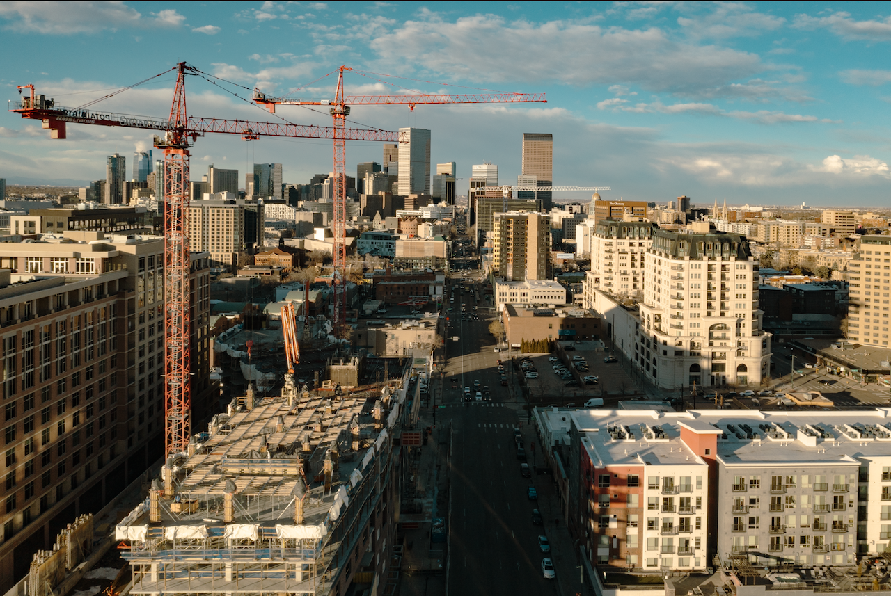
Flying a drone changed how I see construction sites.
Plans on paper only go so far. From the air, you notice patterns, progress, and problems you can’t spot from the ground. At Wonderstruct, I combine my design experience with commercial drone operations. The visuals I capture help teams make decisions and communicate clearly with clients. Our work with Augusta Homes is a great example.
In this article, I cover the Top Five Ways Drones are Used in Commercial & Residential Construction. I explain FAA licensing and pilot certification and share lessons from real projects so you can capture aerial imaging with confidence.
1. Progress Monitoring & Time-Lapse Documentation
Why it works: Visual consistency builds trust.
- Scheduled Flyovers: Certified commercial drone operators conduct weekly flights, creating a reliable visual record that simplifies schedule tracking.
- Automated Time-lapse: Still images can be stitched into short 20–30 second reels for websites or client portals.
- Data Overlays: Compare footage against your CPM schedule, spot delays early, and adjust critical paths before they snowball.
Lesson Learned: Weather Can End a Flight Before It Starts:
Weather can shut a flight down fast. Early in my experience, a calm morning turned gusty by afternoon, causing my drone to struggle to stay on course. Now I check METARs, gust forecasts, and temperature fronts before every flight and plan my timing accordingly.
Note: Commercial operations require a valid FAA Part 107 drone license, so many teams partner with licensed pilots or training programs to ensure compliance.
2. Safety Inspections & Risk Mitigation
Why it works: Keep crews safe and sites compliant.
- Roof & Façade Checks: Inspect heights without lifts. UAS pilot license holders can capture high-angle details while staying clear of danger zones.
- Hard-to-Reach Spots: From crane booms to interior shafts, a remote PIC (pilot in command) can maneuver safely to collect critical data.
Lesson Learned: Obstacle Avoidance Is Not Optional:
On one early project, I hit the “Return to Home” button without thinking. The drone began descending straight into a stand of trees. Without obstacle avoidance, it tangled in branches and fell to the concrete in front of me. That day taught me that automation can’t replace awareness. Manual control and good flight planning are your best insurance.
Quick Tip: If you’re considering a drone pilot career, training with Pilot Institute or UAV Coach can build critical flight confidence and safety instincts.
3. Marketing & Stakeholder Engagement
Why it works: Compelling visuals drive action.
- Project Reels: Short aerial walkthroughs embedded on LinkedIn or your project site boost lead generation.
- Investor Presentations: 360° orbit shots bring designs to life in council decks and investor meetings.
- Residential Showcases: For homebuilders, a commercial drone license lets you offer buyers an immersive bird’s-eye preview of entire neighborhoods.
Lesson Learned: Neutral Density Filters Changed Everything:
ND filters changed everything. Early footage often had blown-out skies and flat lighting. Using ND filters and log footage gave me control over exposure and a more polished look.
Side Note: Demand for UAV pilots is climbing, especially for those who pair strong visuals with compliance to 14 CFR Part 61.

4. Environmental & Regulatory Compliance
Why it works: Protect resources and avoid fines.
- Erosion Control Checks: Aerial scans help monitor silt fences and stormwater measures over time.
- Habitat Mapping: Document wetlands and buffer zones to satisfy permitting agencies.
- Dust & Emissions: Drones equipped with sensors can flag environmental issues before they escalate.
Lesson Learned: Compliance Is a Mindset, Not a Checkbox:
Flying commercially means understanding more than just Part 107. Local permitting, restricted airspace, and environmental zones can all impact how and where you fly. I’ve learned to treat every site as its own airspace puzzle: one that demands careful prep, not improvisation.
Compliance Reminder: Always register your aircraft with the Federal Aviation Administration and ensure your operations are covered by the proper license and insurance.
5. Aerial Imaging as a Strategic Asset
Why it works: Drones don’t just collect footage, they change how teams work.
- Faster Decision-Making: Visual data gets everyone on the same page.
- Transparency: Time-stamped imagery builds trust between owners, contractors, and stakeholders.
- Efficiency: One pilot can cover ground that would take hours on foot.
Lesson Learned: Every Flight Tells a Story:
Every flight tells a story. Documenting steel going up, capturing stormwater basins, or showing homeowners their lot from above taught me that framing matters. How you capture footage affects how the story lands.
Getting Started: From Zero to Licensed Pilot
- Choose Your Path: Enroll in a Part 107 course through a trusted program.
- Ground School & Exam: Complete drone pilot ground school and pass the FAA exam to earn your remote pilot certification.
- Register & Insure: Register your aircraft, secure insurance, and establish your operational framework.
- Fly & Document: With a certificate in hand, you can deploy your aircraft for inspections, storytelling, and high-impact marketing.
Final Takeaway
Drones aren’t just “cool gadgets,” they’re strategic tools that drive efficiency, transparency, and engagement throughout the construction lifecycle. Whether you’re a builder, architect, or project manager, integrating aerial imaging with certified pilots elevates your ability to deliver projects on time and on budget.
Contact Wonderstruct to see your next project from above.
Subscribe to receive the latest columns posts to your inbox every week.

.jpg)

